In the Land of Hoodoos

Friday May 4 to Tuesday May 8
I have wanted to visit Bryce Canyon National Park for several years, so I’m excited about finally going there. The Bryce visitors center and campgrounds are at about 8,000 feet elevation, meaning it doesn’t warm up until much later than the other national parks in Utah. I have been watching the weather for the last several weeks and it has been cold with lows in the teens and snow. As it works out when it is time for me to leave the Paria River, Bryce has several days of warmer weather in the forecast. Just what I’ve been looking for!
Dixie National Forest abuts the north side of the park, and has a nice area of dispersed camping that is only one mile from the park entrance. So that’s my destination. I find this nice, level site on FR 1173 a short distance in from Hwy 63.
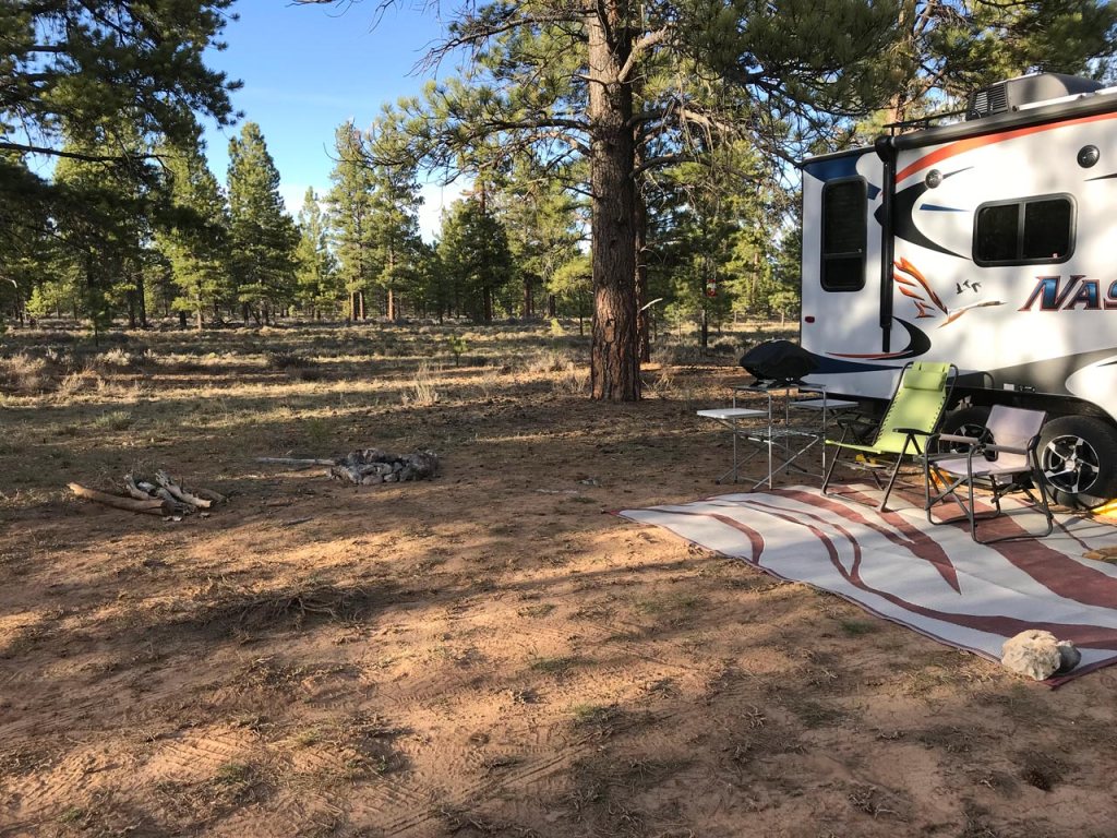
Dixie National Forest Campsite near Bryce Canyon NP
Although there are no big views, it’s in a nice ponderosa pine forest with a mixture of mature and younger trees. I like it. I seemed to be on the travel path for the local mule deer; they would pass by my camp each morning and evening. I also saw a pronghorn out my back window. That was a nice surprise. It was very quiet here. A little traffic on the weekend, but not bad. I much prefer this to being jammed into a full campground inside the park.
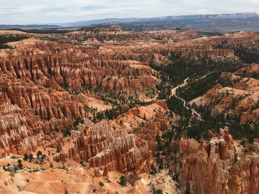
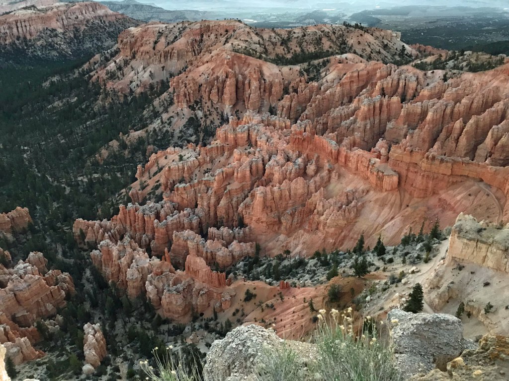
Usually the parks are pretty busy on the weekends, so I hang around camp and do a few things. Monday morning I’m off to the park. Surprisingly there isn’t much of a line at the entrance. After a stop at the visitors center, I drive along the park road. Bryce is a fairly small park, at least the developed part with road access. It’s just about 20 miles from the entrance out to the end of Hwy 63 at Rainbow Point. Along the way I stop at many of the viewpoints and overlooks.
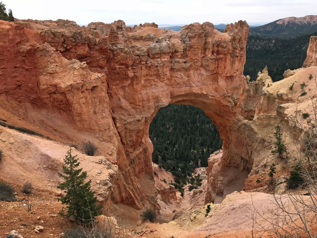
Natural Bridge
At Rainbow Point I walk the Bristlecone Loop, a short one mile hike. Afterwards I drive back, stopping at a few points I had skipped on the way out.
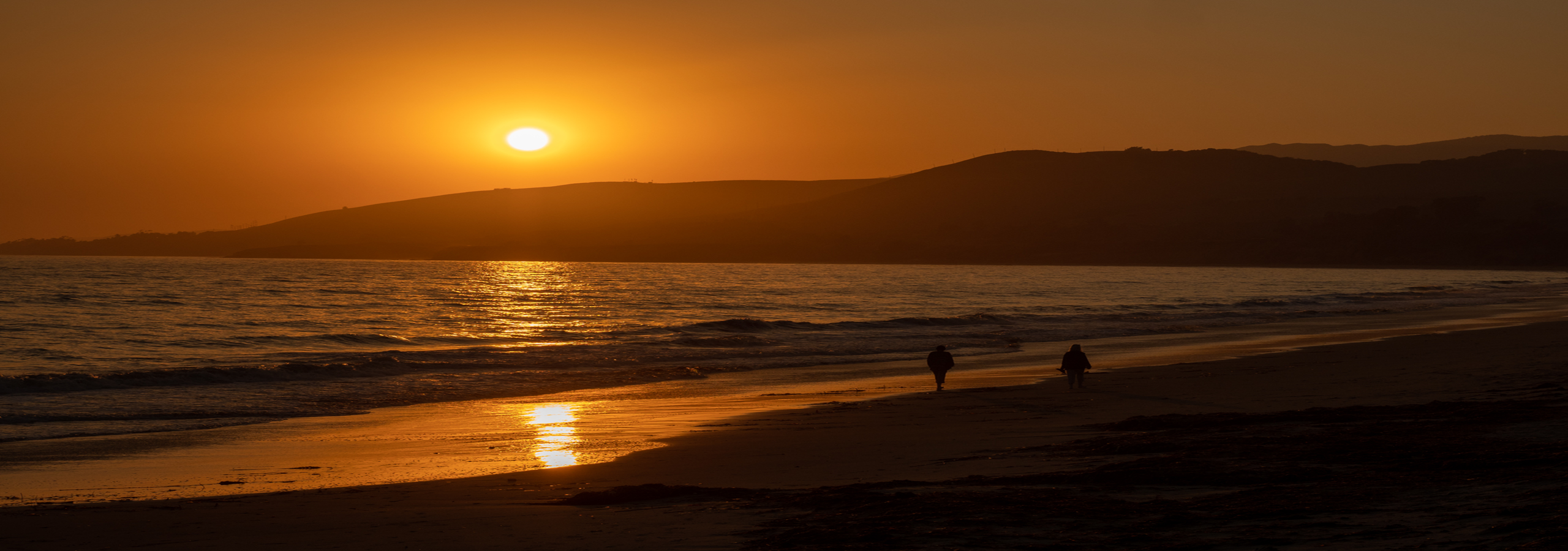
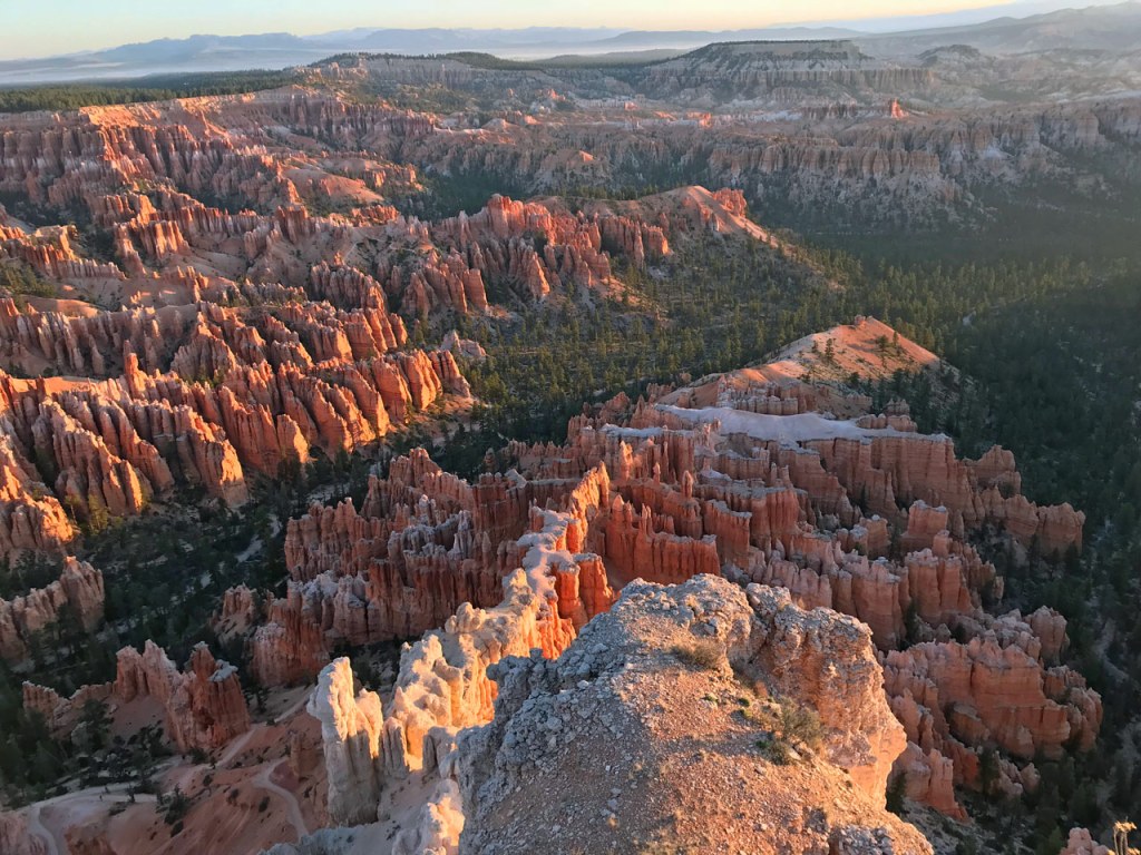
Tuesday morning I’m up at 4:30am to see the sunrise at Bryce Point. I’m not a morning person, so I don’t see a lot of sunrises – you may have noticed there aren’t many sunrise photos on my blog 🙂 I’m all about sunsets, haha!
Just starting to get light…
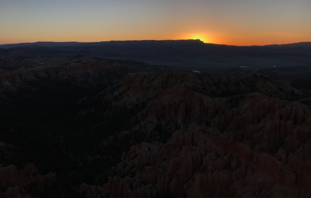
There’s the sun…
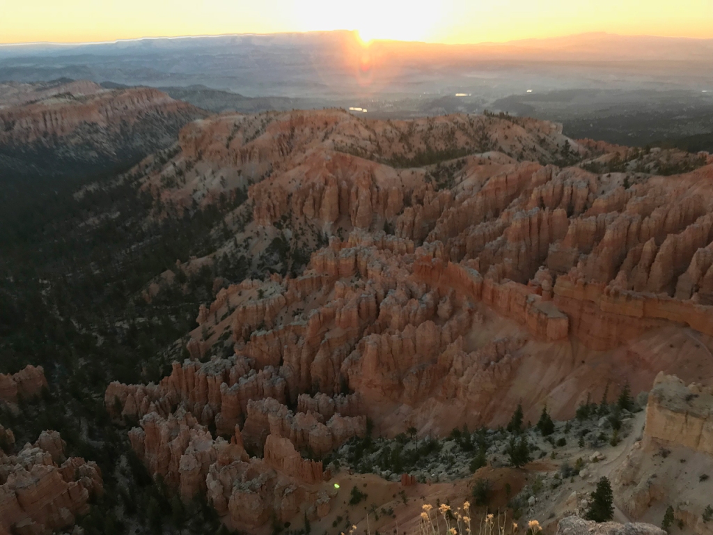
A few of the hoodoos are just starting to glow…
Sunlight reaches the rest of the amphitheater…
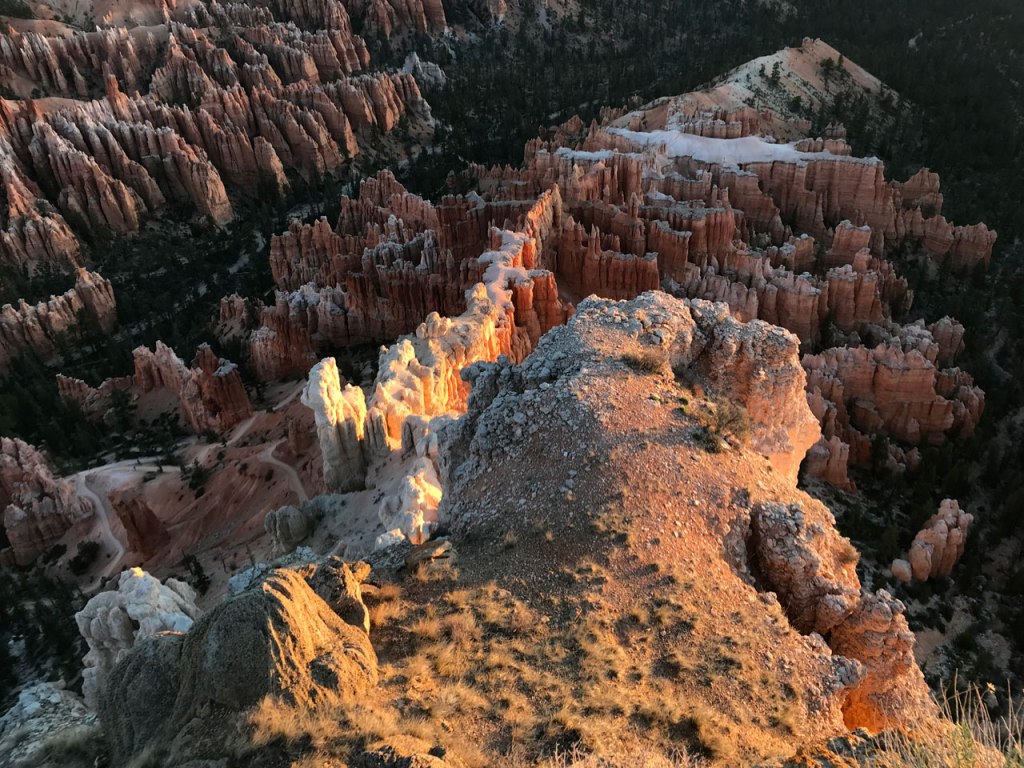
A little after 7am, I leave Bryce Point and drive to Sunset Point. Sunrise and Sunset Points are the two busiest viewpoints. I skipped them yesterday since I planned to come here this morning. This early there are only a handful of vehicles in the parking lot. In a little while, it will be jam packed.
Due to the orientation of the canyon here, the sunlight is just lighting up this area. I actually think it was prettier than Bryce Point. The hoodoos look translucent.
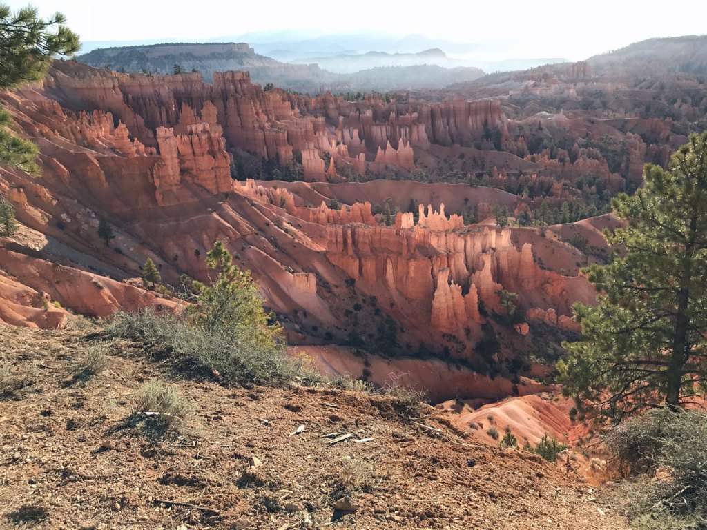
Sunset Point
Sunset Point
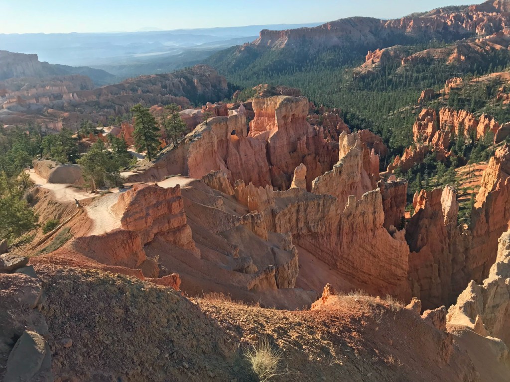
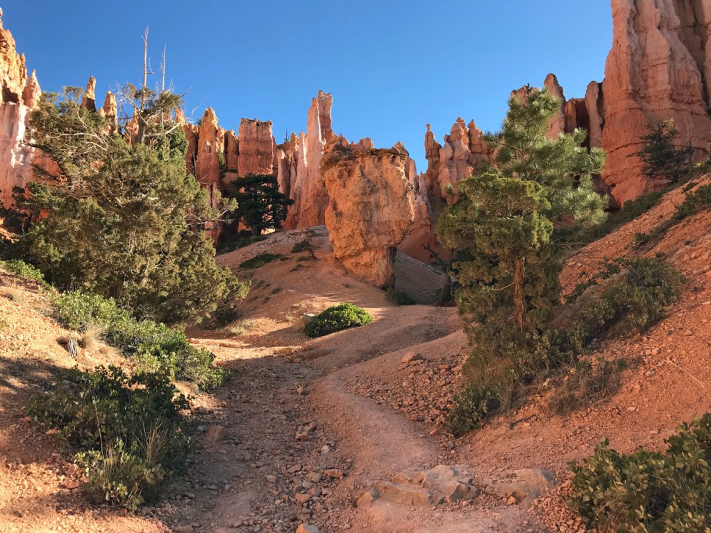
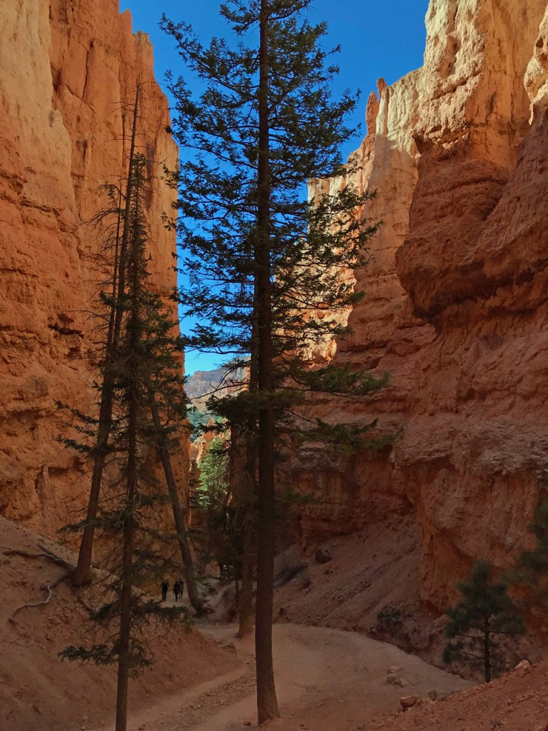
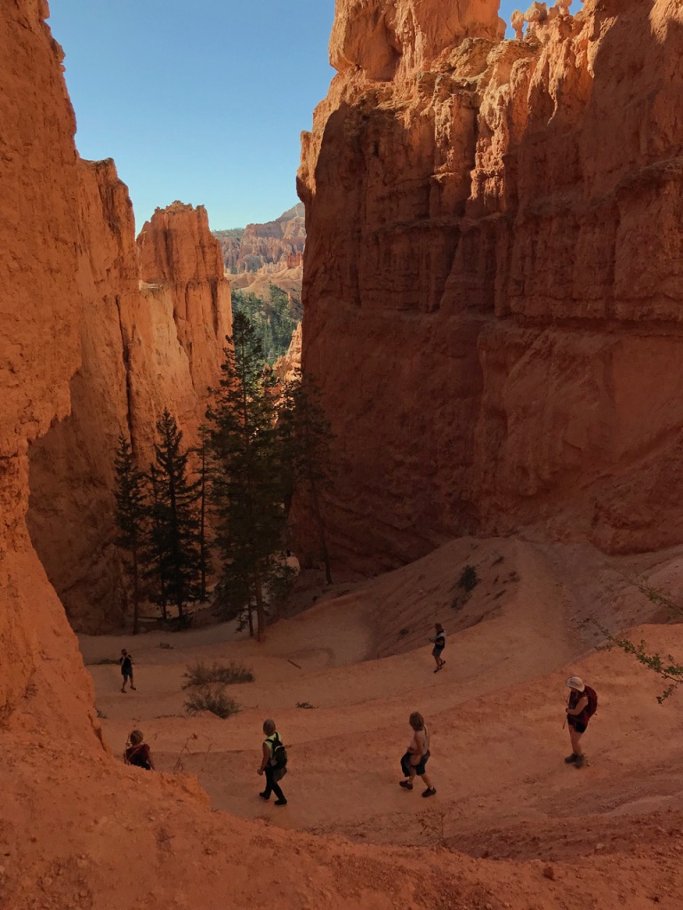
One of the easiest trails that goes down into the canyon starts at either Sunset or Sunrise Points. I highlighted the trail on this snapshot of the park map.
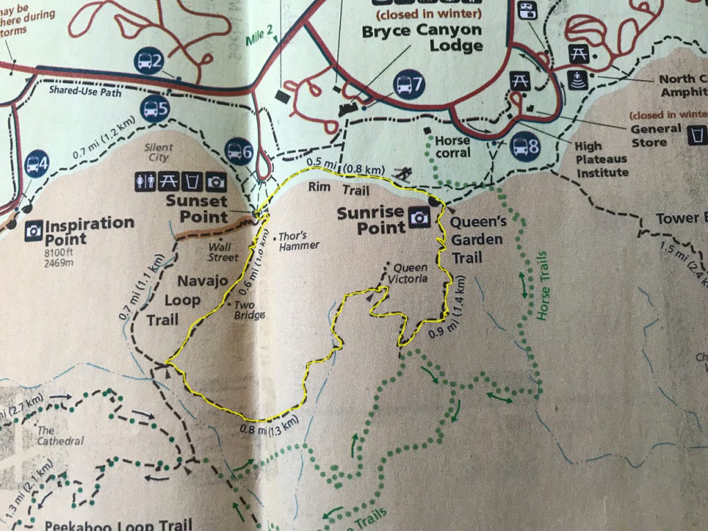
I start at Sunset Point and walk a half mile along the rim to Sunrise Point. From there, the hike descends into the canyon on Queen’s Garden Trail and loops around to the Two Bridges side of the Navajo Loop Trail, which ascends back up to Sunset Point. The Wall Street section of Navajo Loop is still closed due to winter conditions. If it is open, that would be an alternate route.
If you decide to hike this loop, the starting point would depend on how you like to do the downhill part. From Sunrise Point, the Queen’s Loop trail makes a gradual descent into the canyon over a distance of about 1.5 miles. Going this way the total descent was 618 feet (per my GPS app). The ascent back to the rim is made in about .6 mile on the Navajo Loop section. This is much steeper, so one may rather spread the ascent out over a longer distance and do the descent over the shorter distance. Either direction, this is a fairly easy hike. I missed doing the Queen Victoria section, so I hiked 2.54 miles, instead of the 2.9 the park service lists as the distance.
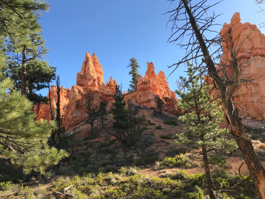
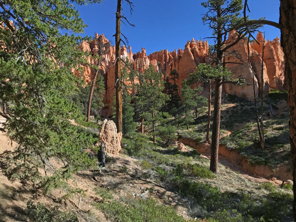
Some photos along the trail…
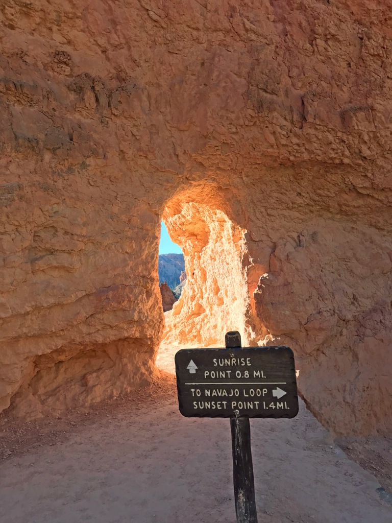
The trail passes through a few tunnels that have been constructed in the sandstone
Looking down the Navajo Loop trail on the ascent to the canyon rim
Looking back at the switch backs on Navajo Loop trail
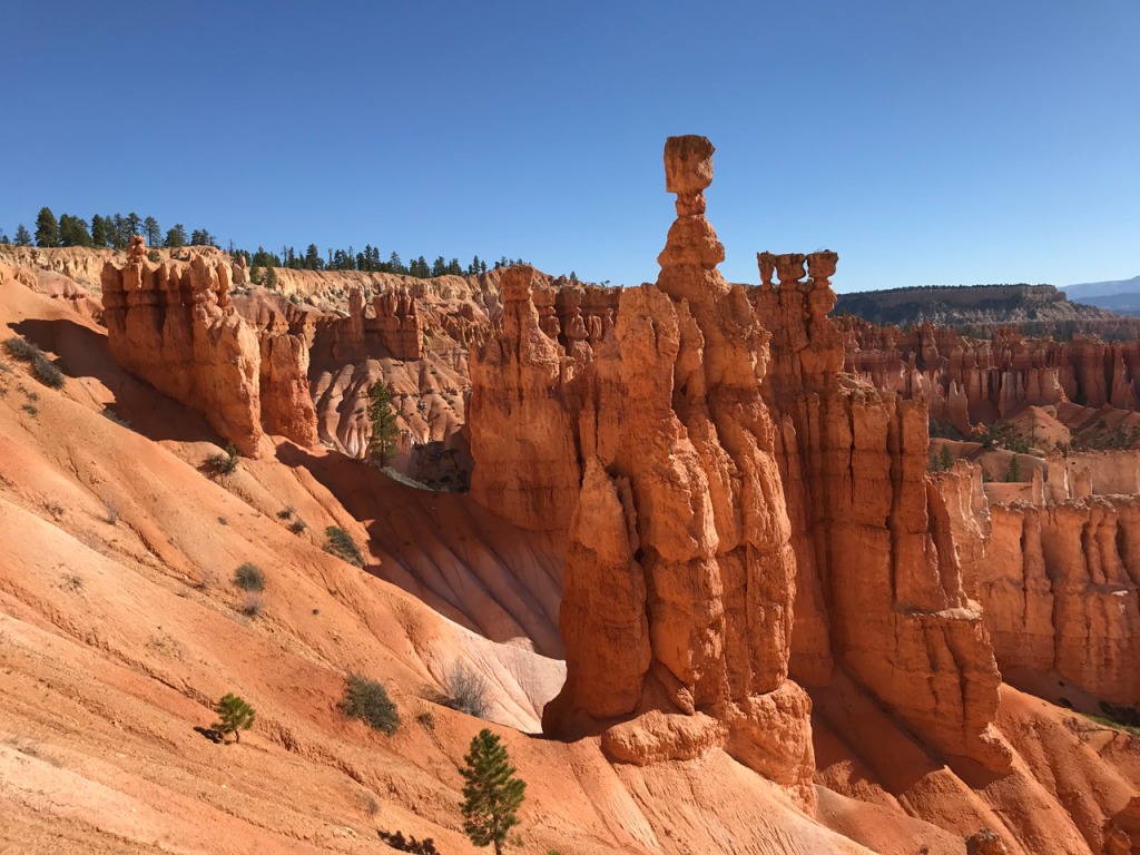
Thor’s Hammer
I had planned to stay here until Thursday or Friday. But there really isn’t a whole lot more to do. Plus, there are high winds in the forecast for Thursday through Sunday. Taking that into consideration, I decide to leave Wednesday morning. I pack up camp so I can get an early start. I’ll continue east on Hwy 12 to Escalante, UT. More on that coming up!

Excellent photos ! Did you bother with a weight distribution setup / anti-sway bar for that Nash 17K ? Smooth tow, I bet in any case.
LikeLike
Thanks! I have an Equalizer 4 point WD/anti sway. It works great. When semis blow past me the Nash doesn’t even move. I should add that info to my post about the Nash.
LikeLike
I love Bryce’s Park, These photos take me back, I was there in 2011 and am looking forward to another visit. Your photos are wonderful… It is such a different kind of place, unique.
LikeLike
Hi Maggie, thanks so much! Bryce was very awe inspiring. As many photos as I had seen if it over the years, there was nothing like actually being there. I really loved watching the sun rise. Hope you get to visit again soon.
LikeLiked by 1 person
Love the Ponderosa pines. Have you visited the Wheeler Geologic Area near Creede Colorado? It has an eroded outcropping of volcanic ash and looks similar to Bryce (but on a smaller scale).
LikeLike
Hi Brian, I haven’t visited Wheeler Geologic Area yet, but would like to. It sounds like an interesting place.
LikeLike