Back to the Sonoran Desert

February 10, Saturday
This morning I get on the road at 10am PT, but since I’m heading east, after about 10 miles I enter mountain time zone, and promptly lose an hour. 😦 There are a couple things I need to pick up at Fry’s so I exit at Fortuna Road. The Shell station next door has a dump station and is my next stop. The fee is a very reasonable $5.00. When leaving camp I had gone west two miles on I-8 to the rest stop which has potable water and filled my fresh water tank. So I am set for my next camp.
After taking care of these chores, I board I-8 East. About 45 miles later at Gila Bend, I exit onto Hwy 85 South. This will take me another 45 miles to Ajo. It’s 4pm as I approach Ajo. My plan is to find a boondock site near Ajo or a little further south near Why. It’s too late in the day to look for a site, so I go to Dennison Campground at Ajo Regional Park a couple miles north of town. There is a roping arena here and at one time the campground was operated more formally by Pima County with a dump station and water. These are no longer available and the campground is reverting to nature. The sites are only vaguely distinguishable. So you just find a spot and pull in. There is no fee to camp here. I believe there is some type of gathering going on as there are a lot of rigs. But, I’m only here for the night. I find a level spot not too close to others and settle in, enjoying another pretty sunset.

Sunset at Dennison Campground
February 11, Sunday
This morning I leave Dennison Campground about 9am to check out some boondocking areas. My thought is to set up a base camp where I can explore the area including down into Organ Pipe Cactus National Monument. So instead of camping near Ajo, I decide to go ten miles further south to Why, AZ. This is a very small community. The one local convenience/gas store is called the Whynot. 🙂
The main boondocking area around Why is at Gunsight Wash on the west side of Hwy 85. I pull in there to look for a place. There are quite a few rigs here, mostly concentrated along the wash. I go to the south side of the wash further away from other rigs where I find a spot that is okay, but I wasn’t really feeling it, if you know what I mean. The landscape is mostly creosote bush with a few saguaro, barrel cactus and a few palo verde and ironwood trees. It isn’t the prettiest landscape.
After setting up camp, I take a drive south on Hwy 85. There is another boondocking area on the east side of the highway that I check out. It’s much prettier than where I am with more vegetation and cacti. These signs are pretty much posted at all roads that go off into the country side.

I would like to move over here, but there is no one else camped in this area and I have no service on my phone. I wouldn’t feel safe with no cell service, plus just not being able to get online to take care of business, etc.
I continue driving south to go to Organ Pipe Cactus National Monument. The monument extends to the US/Mexico border.

Organ Pipe Cactus

The northern boundary is only about 5 miles south of my camp, but it is roughly another 25 miles to the visitors center. I stop and take a quick look around and then drive over to the campground to check it out.
From here it is about five miles further south to Lukeville and the border crossing. Then it’s 60 miles to Puerto Penasco (Rocky Point) on the beach, which is a popular tourist destination. I’ve heard RVs can camp right on the beach for $5 per night.

Lukeville Port of Entry
Some photos from around camp.

Ocotillo in bloom

Barrel Cactus

The rigs in the background on each side are my closest neighbors
February 12, Monday
This morning I drive into Ajo to check out the town. The main focal point is the historic Spanish Colonial plaza, which is very lovely. I stop in at the post office and the visitors center.


Ajo was a company town for the open pit New Cornelia Copper Mine. All those dirt piles in the photo below are tailings or related to the mine. The mine pit is one and half miles across and 1,100 feet deep. Full scale mining began in 1917 and the mine was shut down in 1985.

With the loss of the mine jobs, Ajo went into decline. The town wants to re-invent itself as an artist’s colony. As part of this effort, the historic Curley School has been converted to artisan apartments/workspaces.

Curley School at the end of the road with red roof & historic church building in foreground
Hopefully the efforts will bear fruit and the town will begin to prosper again. Right now the services available are pretty limited. There is a good IGA grocery store though.
Street murals are seen along an old warehouse type building.


Next I go to the headquarters for the Cabeza Prieta National Wildlife Refuge which is also located in the area. I learn that there are only a couple roads going into the refuge and they are narrow 4wd with some spots potentially sandy enough for even 4wd to get stuck. And no cell service in there. It is a fairly long drive in to get to anything of interest. There is one road going up to a pass that would be about 4 hours round trip and hiking is pretty limited. This doesn’t sound too appealing as I don’t think I want to drive in there alone. There is also still considerable smuggling activity in that area I’m told.
But I do learn that the east side of the Barry M. Goldwater Air Force Range is open to the public for hiking. This is on the east side of Hwy 85 – no bombs dropped on that side. 🙂 To visit one is required to watch a short video and complete an application to obtain a permit, which is free. There are some good hiking areas right off the highway. So I get the permit and plan to do some hikes there. It is just north of Ajo.
It was pretty cloudy today and rain in the forecast for the next three or four days, much needed. The forecast has been jumping all over the place though, so who knows.

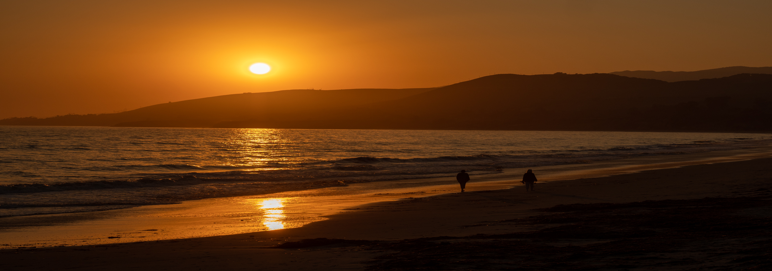
Sunset at Gunsight Wash

Great post! I have never heard of Ajo before this! nice pics! I love the idea of boondocking, but being alone would be tough, I’m not as brave as I need to be just yet 🙂 Good for you!
LikeLiked by 1 person
Thanks! The Sonoran Desert is really beautiful around here. Although this year it’s extremely dry. Precipitation is way below average. I love it here though.
I understand about boondocking. Each person has to do what is within their comfort level. If you want to give it a try there are a lot of boondocking areas that are vey popular. So if you camped there you would have people nearby. For example at Gunsight Wash where I first camped there were lots of rigs. There were some nice spots open along the wash where the neighbors would be close. If you go out and walk you will meet people there and that would probably increase the comfort level as well.
Good luck!
>
LikeLiked by 1 person