Dragoon Mountains

In late March I left the Tucson area. I enjoyed Tucson and the festivals, films, etc. But I was ready to leave the city for quieter places. I had briefly visited the Dragoon Mountains in October when I was in Sierra Vista. I plan to spend several weeks in southeast Arizona exploring some of the mountain ranges.
View large photos/slideshow on Flickr
The Dragoons are south of I-10 and east of Benson. I-10 passes through Texas Canyon, which is the northern edge of the Dragoons. The Texas Canyon rest area is a great place to stop for viewing the exotic rock formations the Dragoons are known for.
The Dragoons lie within the Coronado National Forest. There is dispersed camping on FR678 off of Middlemarch Rd, which terminates on Hwy 80 about a mile north of Tombstone. I found a nice campsite at the base of some cliffs. I learned this is also a very popular rock climbing area.

Dragoon Mountains campsite
One morning I hiked a trail that goes up a valley along the cliffs. This is at about 5,000ft in mesquite grasslands. It’s a big change from the Sonoran desert I have been in the last few months.

Along hiking trail near camp
Further north on FR678 is Council Rocks, which tradition has as the place where the Chiricahua Apache leader, Cochise, signed a peace treaty in 1872. It isn’t known with certainty where the exact location of the treaty signing was. But in any event, this area was used by the Chiricahua Apaches as a refuge during the 1860s.

Council Rocks canyon

Climbing up to Council Rocks

There are several sheltered areas among the rocks
There is also evidence that this place had been occupied for centuries. There are several metate stones for grinding grain as well as pictographs that are estimated to be 1,000 years old. The pictographs have weathered and are pretty faint.
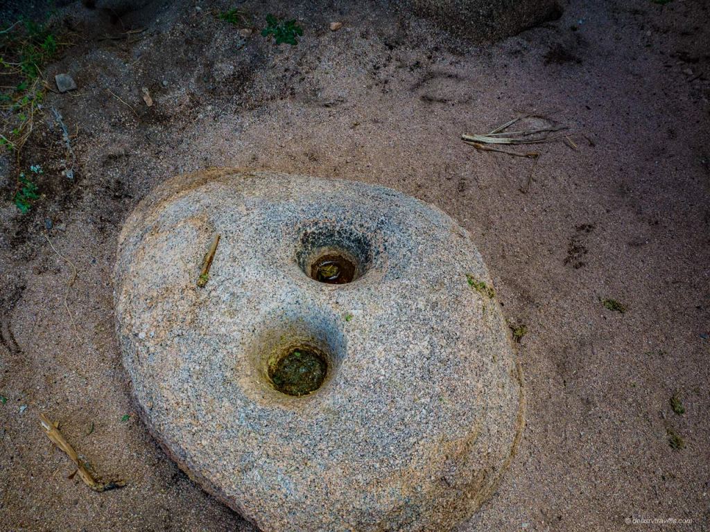
one of the rocks used for grinding

One thousand year old pictographs
I did a few other hikes while here, there are several trails in the area.
Another day I drove east on Middlemarch Rd. across the Dragoons. There has been a wildfire along this route so it is pretty barren.
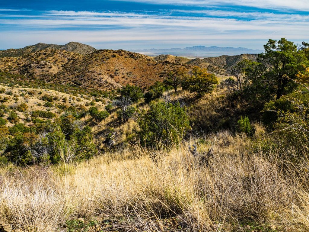
At the crest of MIddlemarch Road looking to the northeast

This small doe was grazing near the road
The road leads down into the Sulphur Springs Valley, which has some beautiful grasslands.

Looking across the Sulphur Springs Valley to the east slope of Dragoon Mountains and Cochise Stronghold
A little to the north is Cochise Stronghold. This is just across the mountain from the canyon of Council Rocks. These two canyons were used as refuge for several years by the Apache until the signing of a peace treaty in 1872.


The mountains were pretty reds and yellows
There is a small forest service campground at the mouth of the canyon. It is suitable for tents, vans, and very small RVs or trailers. There are low hanging branches along the road and in the campsites. A hiking trail begins in the campground and leads up into the canyon.
After checking out the campground, I head east across the valley. There were large fields of poppies and other flowers in bloom.

Fields of poppies were scattered around the valley

A closer look
The Chiricahua Mountains are to the east. These mountains are also part of the Coronado National Forest, and on the western slope is the Chiricahua National Monument. This was a popular place with the local residents even before it was designated as a national monument. It was known then as the Wonderland of Rocks. It was afternoon by the time I arrived. I just had time to stop at the visitor center, check out the campground and then drive the park road that ends at Massai Point overlook. This is a beautiful area with a jumble of rock formations.

View from Massai Point Overlook
I walked a short trail that made a loop along the edge of the canyon, giving great views down.

Along Massai Point trail
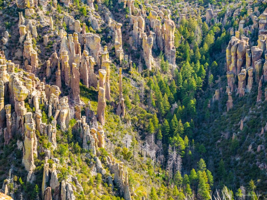
Amazing rock formations
There are several hiking trails. The park also has a van shuttle that will transport hikers to Massai Point. From there one can hike some of the trails down into the canyon and back to the visitors center, which would be about eight miles depending on the route taken.
This was primarily an exploration day to check out the different areas. I want to return to the national monument another time to hike some of the trails. There is a campground, reservations are generally required as it stays full during the busy season.
The San Pedro River flows through the valley west of Tombstone. Some 40 miles of the river corridor from Hereford north to St. David was designated as the San Pedro Riparian National Conservation Area in 1988. It contains 57,000 acres. The San Pedro is one of the few rivers in Arizona that flows year around, although it is small other than during the monsoon season. It is also an important corridor for migrant and nesting birds. One morning I drove to the access point on Charleston Road for a short hike and birding.

San Pedro River
I still don’t have a long lens for my camera, which means I am unable to get decent bird photos. In about an hour, I saw more than 15 species of birds. The prettiest were the vermilion flycatchers. They are a stunning red!
The temps have been very warm, which means the rattlesnakes should be coming out. Several places the path went through high grass which made me nervous. As I was on the way back to the parking area, I saw the first rattlesnake of the season. It was right on the trail, of course; I was about three feet away when I saw it. It showed no sign of moving, so I finally cut up around it, keeping an eye out for any companions 🙂

Lookout!!
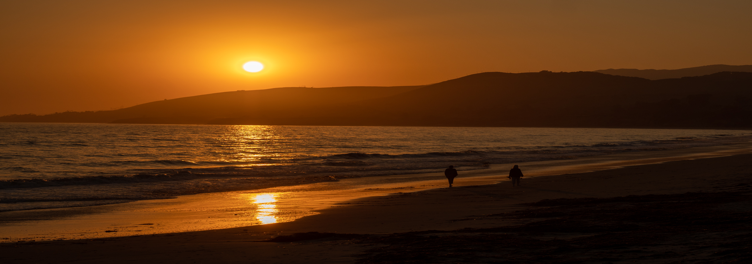
From the Dragoons, I plan to head to the east side of the Chiricahua Mountains. Mid-April the spring bird migration is going strong, and I want to do some birding in that area. There were many beautiful sunsets while I was here. I’ll close with a couple of sunset photos!


I’m putting this on my list. We want to head out west for winter season, and this may be a sweet spot! These photographs are beautiful. It looks so peaceful and so much to explore.
LikeLike
Thanks! It is a very peaceful spot. Arizona is a great place to spend the winter. There is a lot to see. Have fun planning your trip!
LikeLiked by 1 person